
© webdesign@chaddesley-corbett.co.uk - 2024

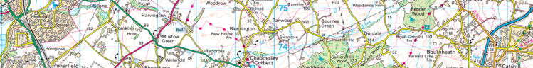
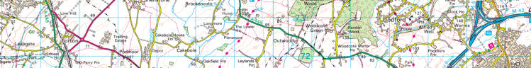
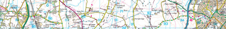
FOOTPATHS
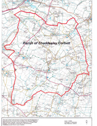
Chaddesley Corbett covers a relatively large 6,079 acres, that is 24.6 square kilometres (9.5 sq mi) with over 50
miles of footpaths and bridal-ways, including the “MONARCH’S WAY”, a 625-mile (1,006 km) long-distance
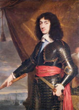
footpath in England that approximates the escape route taken by the 21 yr-old King Charles II in 1651 after
being defeated in the Battle of Worcester. It runs from Worcester via Bristol and Yeovil to Brighton and is the
country’s longest inland LDWA, making its way through 21 different city and county areas.
King Charles, in exile
(2 years later - aged 23)
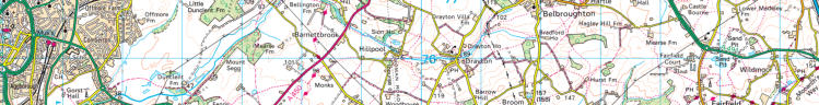
Follow Charles’ route with these signs
The complete route comes in
on marker posts.
three stages:- the Midlands,
the Cotswolds & Mendips,
and the Downs.
(Click to enlarge)
Trace Charles’ route(s) through Chaddesley by following the ….…….. symbols
from the bottom to the top in the middle of the map (as he sought to cross the Severn, westwards)
and on the right-hand edge, from the top to the bottom (his travels south).


0
0.5 1 1.5 2 2.5 3 3.5 4 4.5
5 km
Scale 1:50000

Download a copy of the above map
HERE
in .pdf version
(Please remember to set your printer to <Landscape> to occupy all of an A4 page)


Kelvyn Jones
- from Brierley Hill, West Mids.
In reviewing
Chaddesley and Nutnells Wood Circular Walk
,
https://www.alltrails.com/trail/england/worcestershire/chaddesley-and-nutnells-wood-circular
as on display by the ‘Chef & Brewer chain (
Mare & Colt, Summerfield
),
https://www.alltrails.com/lists/walks-near-the-mare-colt-summerfield-a5cdd4a
wrote_
“Just
be
careful
parking
opposite
the
church,
village
mentality
is
on
steroids
in
Chaddesley
and
they
think
they
own
the
public
road outside their houses.
We
parked
up
and
then
the
village
idiot
turned
up
and
reversed
right
back
to
within
6"
on
my
front
bumper.
He
was
still
there
3
hrs later upon our return waiting to grab the space back. All rather sad.
He should consider moving to the neighbouring village of Bell End.”
Well, that’s one opinion.
‘Other opinions are available’ .. as Alan Davies might say on Q.I.


